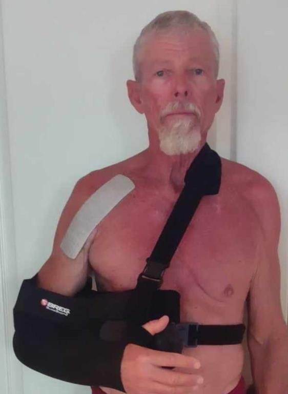
I have limited information to give you in this report. Between the pier being partially closed for the July 4th fireworks, the sweltering heat and me having shoulder replacement surgery, I was not on the pier much to gather info. I will be on the injured reserve list for a few months so I will need you to send pictures and catch reports. I will be coming to the pier some to watch but will not be able to fish or stay all day. Your help providing info will be great. You can send it by text, messenger or email: 770-265-2879 or SLP053@BELLSOUTH.NET Thanks!
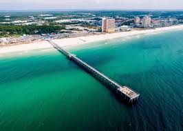
Our water temperature is hot. It fluctuated from 85.8 to 90.0 during the week. This didn’t deter the fishermen the few days around the July 4th holiday. However, it did affect our catches. Friday was our best day. Species caught were: King Mackerel, Bonita, Hardtails, Cigar minnows and Alewives. This is what the pier population looked like at 06:30, July 4th:

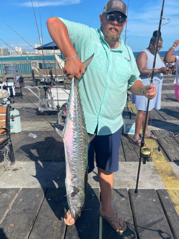
Friday morning, a visiting angler decked a nice King Mackerel. Unfortunately, I was unable to get a picture. A few, (report of 3) Bonita were decked, all being larger than the ones we’ve been catching. They were in the 8-pound range. Late afternoon, Jeffery landed a nice King.
Daily activity:
Thursday: water temp 86.7 – 89.6
Friday: water temp 86.4 – 88.9 Three Bonita and one King Mackerel (reported as 20#) in the am, A King Mackerel in afternoon, A few Cigar minnows and Alewives.
Saturday: water temp 85.8 – 88.7 A few Cigar minnows.
Sunday: water temp 87.1 – 89.4 Hardtails, a Bonita and Cigar minnows.
Monday: water temp 87.8 – 90.0 A few Cigar minnows.
Tuesday: water temp. 87.6 – 89.4
Wednesday: water temp 86.7 – 88.0
Red Tide status: The red tide organism, Karenia brevis, was not observed in samples collected statewide over the past week. We continue to use satellite imagery (USF and NOAA NCCOS) to help track nearshore and offshore conditions. No reports of fish kills suspected to be related to red tide were received over the past week.
Tides Link
https://tides4fishing.com/us/florida-west-coast/panama-cityngin g
Full Moon Sunday July 21, 2024 - New Moon Sunday Aug. 21, 2024
Tides for the upcoming week:
Sunrise: 5:44am Sunset: 7:35pm
Thursday 11th. 9:59pm Low 0.5 1:13pm High 1.1
Friday 8:32am Low 0.9 5:19am High 0.9
8:58pm Low 0.6 1:25pm High 0.9
Saturday 7:42pm Low 0.6 4:55am High 1.0
Sunday 4:49pm Low 0.4 4:32am High 1.2
Monday 5:08pm Low 0.2 4:50am High 1.4
Tuesday 5:40pm Low 0.0 5:33am High 1.6
Wednesday 17th. 6:20pm Low -0.1 6:20am High 1.7
Sunrise: 5:53am Sunset: 7:44pm CDST
The Marine forecast for the next several days is:
THURSDAY
Northwest winds 5 to 10 knots. Seas around 2 feet. Wave Detail: Southwest 2 feet at 6 seconds. Protected waters a light chop. A chance of showers and thunderstorms.
THURSDAY NIGHT
West winds 5 to 10 knots. Seas around 2 feet. Wave Detail: West 1 foot at 4 seconds and south 1 foot at 7 seconds. Protected waters a light chop. A slight chance of showers and thunderstorms in the evening, then a chance of showers and thunderstorms after midnight.
FRIDAY
West winds 5 to 10 knots. Seas around 2 feet. Wave Detail: West 1 foot at 3 seconds and south 1 foot at 7 seconds. Protected waters a light chop. A chance of showers and thunderstorms.
FRIDAY NIGHT
West winds 5 to 10 knots. Seas around 2 feet. Wave Detail: West 1 foot at 3 seconds and south 1 foot at 7 seconds. Protected waters a light chop. A chance of showers and thunderstorms.
SATURDAY
Northwest winds 5 to 10 knots, becoming southwest in the afternoon. Waves 1 foot or less. Wave Detail: West 1 foot at 3 seconds and south 1 foot at 7 seconds. Protected waters a light chop. A chance of showers and thunderstorms.
SATURDAY NIGHT
West winds 5 to 10 knots. Waves 1 foot or less. Protected waters a light chop. A slight chance of showers and thunderstorms in the evening, then a chance of showers and thunderstorms after midnight.
SUNDAY
North winds around 5 knots, becoming south in the afternoon. Waves 1 foot or less. Protected waters smooth. A chance of showers and thunderstorms.
SUNDAY NIGHT
Southwest winds around 5 knots. Waves 1 foot or less. Protected waters smooth. A chance of showers and thunderstorms.
MONDAY
Southwest winds around 5 knots. Waves 1 foot or less. Protected waters smooth. A chance of showers and thunderstorms.
MONDAY NIGHT
Southwest winds around 5 knots. Waves 1 foot or less. Protected waters smooth. A chance of showers and thunderstorms.
(local forecast).
THURSDAY (91/77 rain 15% wind NW-09)
FRIDAY (92/80 rain 15% wind WNW-10)
SATURDAY (91/80 rain 15% wind W-10)
SUNDAY (91/82 rain 24% wind WSW-10)
MONDAY (90/81 rain 45% wind WSW-09)
TUESDAY (89/81 rain 43% wind WSW-09)
WEDNESDAY(89/80 rain 44% wind WSW-09)
PIER MANAGEMENT CONTACT INFORMATION:
Bay County Parks and Recreation – 5304 Majetti Tower Road Panama City, FL 32404
850-248-8730
Vince Martin – Bay Co. Parks Division Manager - vmartin@baycountyfl.gov - 850-896-6580
Tight lines and screaming drags,
Sam